Mapa Clima Tempo Agora - Fotos
by Evposli - Travel, Finance, Goals and Fitness apps
🗂️ Weather
Features Mapa Clima Tempo Agora - Fotos
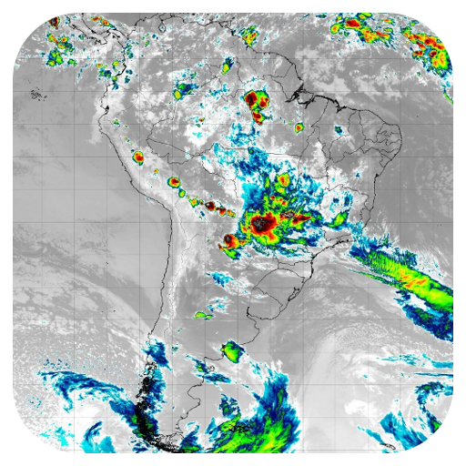
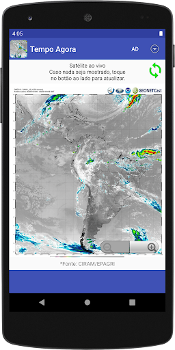
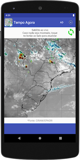
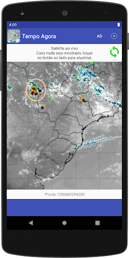
The weather map is now a minimalist app that shows animated maps with satellite images in real time.
Thunderstorms, storms and storms in real time Using the maps, you can determine in advance whether it is a good time to leave the house or prepare for a possible storm.
Satellite photos in real time The animated maps shown by the app are sequences of satellite photos taken in real time over the past few hours and available through the EPAGRI / CIRAM website.
See the weather map in all states of Brazil The map shows satellite photos from all over South America, so it includes all Brazilian states and other countries in South America, such as Argentina, Chile, Paraguay, Uruguay.
Highlights - Use gesture or touch controls to zoom;- Low battery, space and memory consumption;
Camera Features
Advanced camera features with editing capabilities.
Weather Features
Get accurate weather forecasts and real-time updates.
Food & Dining
Discover recipes and order food from your favorite restaurants.
See the Mapa Clima Tempo Agora - Fotos in Action
Get the App Today
Available for Android 8.0 and above